CAZ060
There are no active watches, warnings or advisories
| Will's Hesperia Weather | |||
|---|---|---|---|
| LAST READING AT TIME: 12:30 AM DATE: June 25 2025, time of next update: 12:45 am | |||
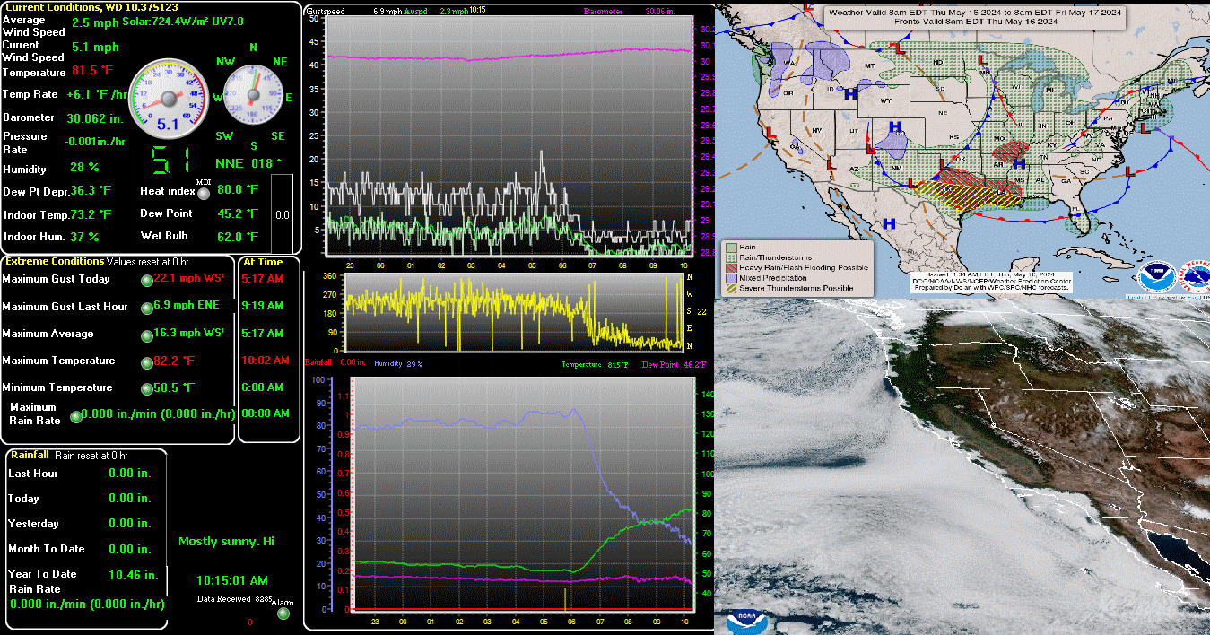
| Current Weather | Night time/Dry/Clear skies | Current Temperature | 61.3°F (16.3°C), Apparent temp 61.1°F |
| Maximum Temperature (since midnight) | 61.3°F at: 12:26 AM | Minimum Temperature (since midnight) | 60.8°F at: 12:00 AM |
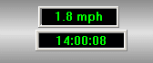
| Average windspeed (ten minute) | 0.0 mph | Wind Direction (ten minute) | SSW (200°) |
| Heat Index | 61.3°F | Maximum Gust (last hour) | 1.8 mph at: 12:28 AM |
| Maximum Gust (since midnight) | 2.3 mph at: 12:28 AM | Maximum 1 minute average (since midnight) | 0.2 mph at: 12:28 AM |
| Rainfall (last hour) | 0.00 in. (0.0 mm) | Rainfall (since midnight) | 0.00 in. (0.0 mm) --- |
| Rainfall This month | 0.00 in. (0.0 mm) | Rainfall To date this year | 4.52 in. (114.8 mm) |
| Maximum rain per minute (last hour) | 0.00 in/min | Maximum rain per hour (last 6 hours) | 0.00 in/hour |
| Yesterdays rainfall | 0.00 in | DewPoint | 43.5°F (Wet Bulb :52.6°F ) |
| Humidity | 52 %, Humidex 60.9°F | Barometer corrected to msl | 30.124 in. (1020.1 hPa) |
| Pressure change | -0.01 in. (last hour) | Trend (last hour) | STEADY |
| Pressure change (last 12 hours) | +0.00 in | Pressure change (last 6 hours) | +0.04 in |
| Current Indoor Temp. 72.9°F | |||
| Current Indoor Hum. 32% | |||
| Current solar | 0 W/m² | Current UV | 0.0 |
| Maximum solar (since midnight) | 0 W/m² | Minimum solar (since midnight) | 0 W/m² |
| Current 00:00 hours of sunshine today, current sky: Night time/Dry/Clear skies | |||
| Sunshine hours for the year: | 438:14 hrs | Sunshine hours for the month: | 77:31 hrs |
| Current evapotranspiration 0.06 inches per day. Yesterday's reading 0.19 | |||
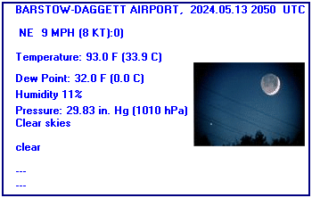
Expires:202506251000;;310846
FPUS56 KSGX 242008
ZFPSGX

Zone Forecast Product for Extreme Southwest California
National Weather Service San Diego CA
108 PM PDT Tue Jun 24 2025


CAZ060-251000-
Apple and Lucerne Valleys-
Including the cities of Victorville, Hesperia, Apple Valley,
and Lucerne Valley
108 PM PDT Tue Jun 24 2025

.TONIGHT...Mostly clear. Lows 55 to 64. Areas of winds west 10 to
15 mph. Gusts to 30 mph...becoming 25 mph overnight.
.WEDNESDAY...Mostly sunny. Warmer. Highs 92 to 99. Areas of winds
west 10 mph becoming north with gusts to 25 mph in the afternoon.
.WEDNESDAY NIGHT...Mostly clear. Lows 60 to 68. Areas of winds
west 10 to 15 mph. Gusts to 30 mph...becoming 25 mph overnight.
.THURSDAY...Mostly sunny. Highs 95 to 102. Areas of winds west to
10 mph becoming southwest with gusts to 30 mph in the afternoon.
.THURSDAY NIGHT...Clear. Lows 60 to 69. Areas of winds southwest
10 to 20 mph. Gusts to 30 mph...becoming 25 mph overnight.
.FRIDAY...Sunny. Highs 96 to 104.
.FRIDAY NIGHT...Clear. Lows 59 to 69.
.SATURDAY...Sunny. Highs 97 to 104.
.SATURDAY NIGHT...Clear. Lows 61 to 70.
.SUNDAY...Sunny. Highs 98 to 107.
.SUNDAY NIGHT...Clear. Lows 61 to 71.
.MONDAY...Sunny. Highs 100 to 108.
.MONDAY NIGHT...Mostly clear. Lows 62 to 71.
.TUESDAY...Sunny. Highs 99 to 108.

$$


Victorville, Southern California Logistics Airport, CA, United States (KVCV) 34-35-50N 117-22-58W
Jun 25, 2025 - 02:35 AM EDT / 2025.06.25 0635 UTC
Wind: from the SSE (160 degrees) at 10 MPH (9 KT):0
Visibility: 10 mile(s):0
Sky conditions: clear
Temperature: 68 F (20 C)
Dew Point: 41 F (5 C)
Relative Humidity: 37%
Pressure (altimeter): 30.04 in. Hg (1017 hPa)
ob: KVCV 250635Z AUTO 16009KT 10SM CLR 20/05 A3004 RMK AO2
cycle: 6
BARSTOW-DAGGETT AIRPORT, CA, United States (KDAG) 34-51N 116-47W 587M
Jun 25, 2025 - 02:50 AM EDT / 2025.06.25 0650 UTC
Wind: from the W (280 degrees) at 7 MPH (6 KT):0
Visibility: 10 mile(s):0
Sky conditions: clear
Temperature: 78.1 F (25.6 C)
Dew Point: 32.0 F (0.0 C)
Relative Humidity: 18%
Pressure (altimeter): 29.93 in. Hg (1013 hPa)
ob: KDAG 250650Z AUTO 28006KT 10SM CLR 26/00 A2993 RMK AO2 SLP108 T02560000
cycle: 7
Use the RELOAD facility on your browser to retrieve the latest data.